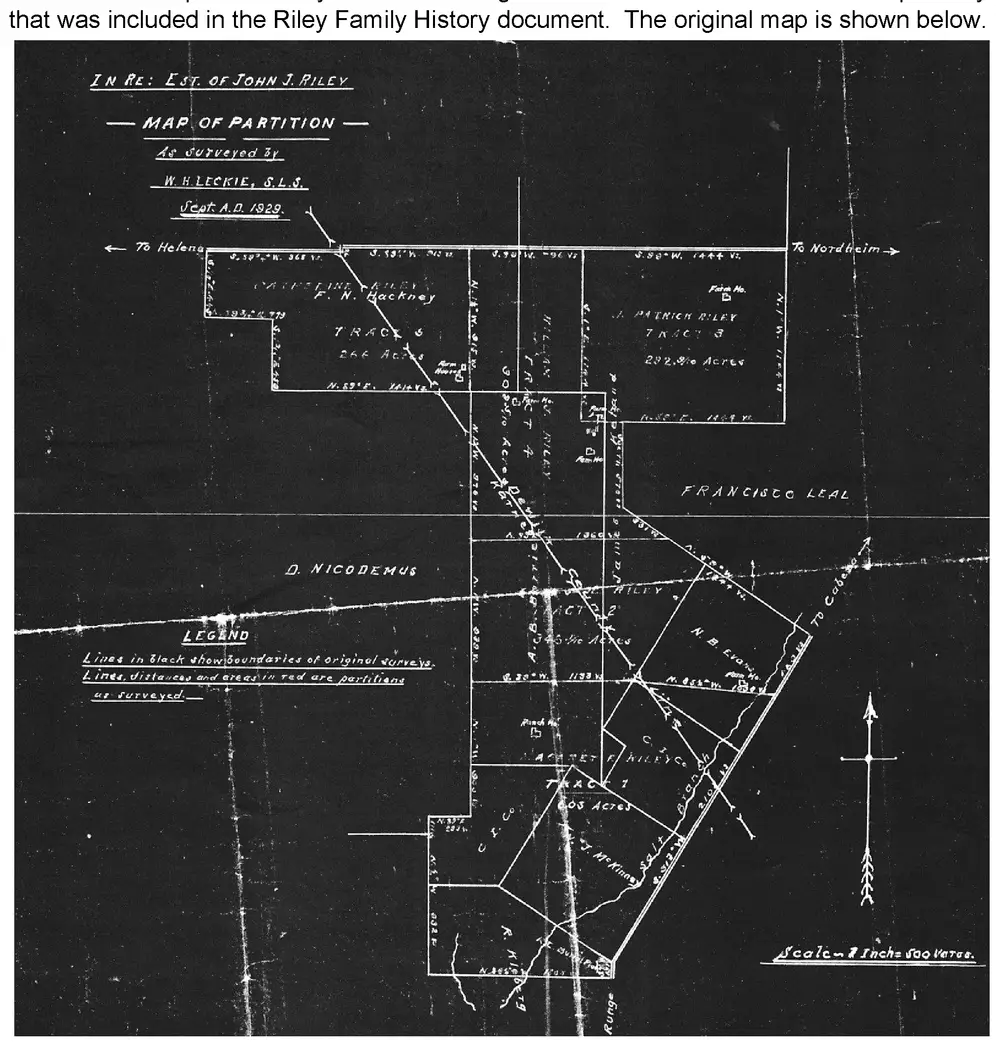
Scanned survey map titled 'IN RE: EST. OF JOHN J. RILEY — MAP OF PARTITION — As surveyed by W.H. Leckie, S.L.S., Sept. A.D. 1929.' Shows tracts of land partitioned among Riley family descendants: Tract 6 (Catherine Riley / F.N. Hackney, 266 Acres), Tract 3 (J. Patrick Riley, 292.9/10 Acres), Tract 4/5 (Wm./A.B. Riley), Tract 2 (A.J. Riley, 345 1/10 Acres), Tract 1 (C.J. Riley, 605 Acres). Roads to Helena, Nordheim, and Cabeza are marked, along with neighboring landowners D. Nicodemus, Francisco Leal, N.B. Evans, J. McKinis, and R. Kief, farm house locations, a legend explaining that black lines show original survey boundaries and red lines/distances show partitions as surveyed, a compass arrow, and a scale note reading 'Scale = 1 Inch = 500 Varas.'
2017 Riley Family History, Addendum A, p. 58
Scanned survey map titled 'IN RE: EST. OF JOHN J. RILEY — MAP OF PARTITION — As surveyed by W.H. Leckie, S.L.S., Sept. A.D. 1929.' Shows tracts of land partitioned among Riley family descendants: Tract 6 (Catherine Riley / F.N. Hackney, 266 Acres), Tract 3 (J. Patrick Riley, 292.9/10 Acres), Tract 4/5 (Wm./A.B. Riley), Tract 2 (A.J. Riley, 345 1/10 Acres), Tract 1 (C.J. Riley, 605 Acres). Roads to Helena, Nordheim, and Cabeza are marked, along with neighboring landowners D. Nicodemus, Francisco Leal, N.B. Evans, J. McKinis, and R. Kief, farm house locations, a legend explaining that black lines show original survey boundaries and red lines/distances show partitions as surveyed, a compass arrow, and a scale note reading 'Scale = 1 Inch = 500 Varas.'2017 Riley Family History, Addendum A, p. 58