Gallery index Plate 52 of 140

Mid-century generations ยท 1942

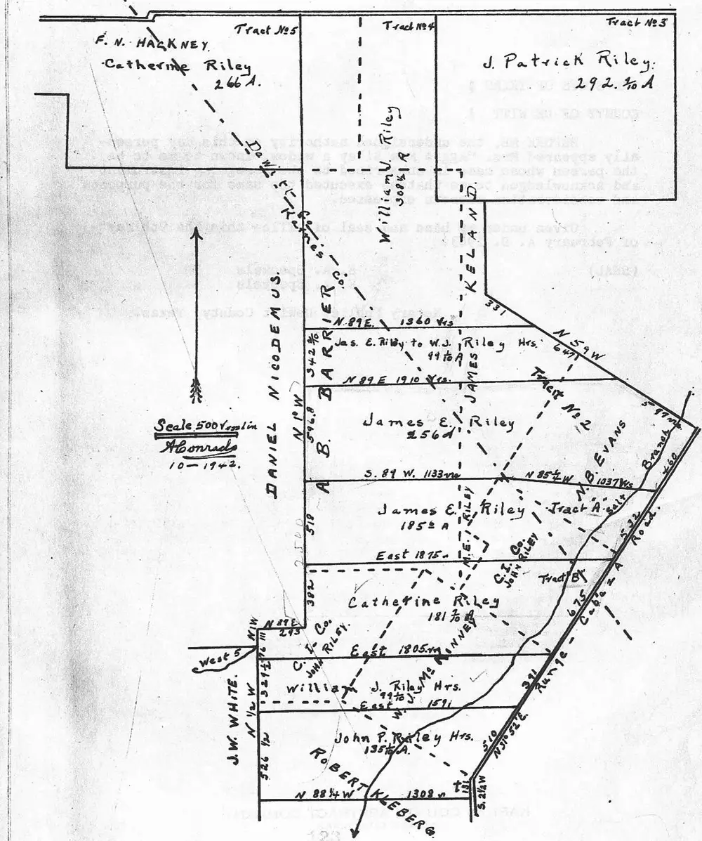
Plat of Division of Margaret E. Riley Land.

2011 Riley Family History, PDF p. 438

Survey plat map showing the division of the Margaret E. Riley land tract into numbered tracts among heirs (F.N. Hackney/Catherine Riley, William U. Riley, J. Patrick Riley, James E. Riley, William J. Riley Hrs., John P. Riley Hrs.), with metes-and-bounds measurements, compass bearings, adjoining landowners (Daniel Nicodemus, A.B. Barrier Co., J.W. White, Robert Kleberg, C.I. Co.), a north arrow, and a scale of 500 varas to the inch, surveyed by A. Conrads in October 1942.
Plat of Division of Margaret E. Riley Land. 2011 Riley Family History, PDF p. 438

People named in this plate

People in the record

  • Margaret E. Riley
  • Catherine Riley
  • William U. Riley
  • James E. Riley
  • William J. Riley
  • John P. Riley
Previous plate Record Proof of Marriages, Births, and Deaths.
Next plate A PLAT OF THE SUBDIVISION OF THE JAMES E. RILEY TRACT, JANUARY 31, 1958, SCALE 1" = 1,000'. Volume 258 - Page 16, Plat reduced App. 20%.